Sign Up to Our Newsletter
Get all the latest Wilkinson Cameras news, offers, event infomation & more direct to your inbox.
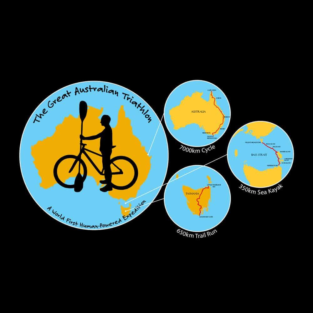
The Great Australian Triathlon: An introduction
Jonathan Doyle - Photographer and Videographer for The GAT - What's in his kit bag?
A reputation which is well deserved. The sea between Tasmania and mainland Australia has seen over 1000 shipwrecks, including the destruction of 5 yachts during the 1998 Sydney to Hobart yacht race, claiming 6 lives. The reason the strait is so dangerous, is because it is very shallow with an average depth of 60m, a stark comparison to the ocean on either side which plunges down to several thousand metres. Wind can travel uninterrupted for thousands of kilometres across the planet to reach the shallow shelf of the Bass Strait, and in doing so can create waves as tall as 20 metres high!
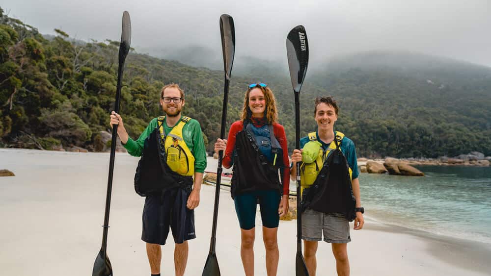
While the obvious choice for the crossing was to wait for the very calmest days to paddle on, the team only had 21 days to complete it as Aidan Cameron and Alie Repetto, the kayakers joining Ben, had to return to Sydney in time to start the next semester of university.
How the hell was I going to film Ben kayaking across the Bass Strait? I don't kayak and with such a limited budget, hiring a boat was never really an option. I decided that the best course of action was to base myself on Flinders Island, the largest island the team would stop at during the crossing. The island can be accessed by a 9 hour ferry crossing which is often described as an adventure in itself. However, unfortunate timings meant I would miss its departure by a day and so in order to avoid risking missing the team altogether, I opted to fly to Flinders Island on a 6 seater plane instead. My equipment list was somewhat more limited than in leg one as I could only take what I could carry and I somehow had to squeeze in my camping gear too. With just 20 minutes to pack before my flight left, I threw everything into a couple of bags and miraculously the only items I forgot were the sun cream and a change of clothes!
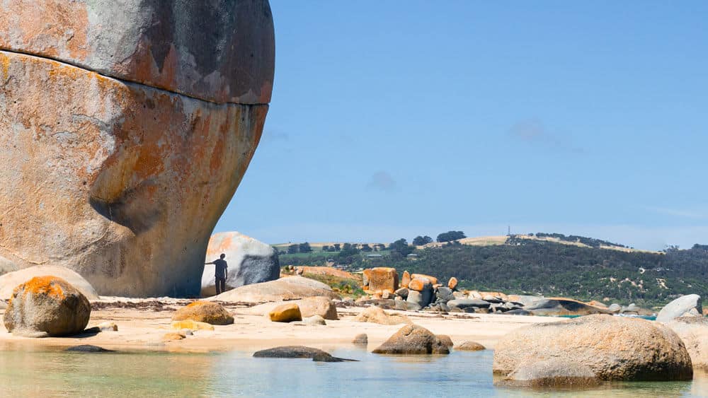
I was lucky to ride shotgun on the flight over to the island, and my luck continued throughout the day. I managed to blag a lift from the aviation company to find somewhere to hire a car, where I then, managed to obtain the very last hire car available on the Island! At length I found myself set up and camping at Trousers Point, a perfect campsite situated just inside Strzelecki National Park right on the edge of a white-sand beach. My watch had begun.
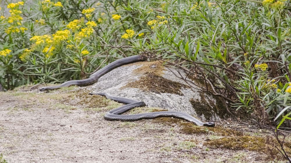
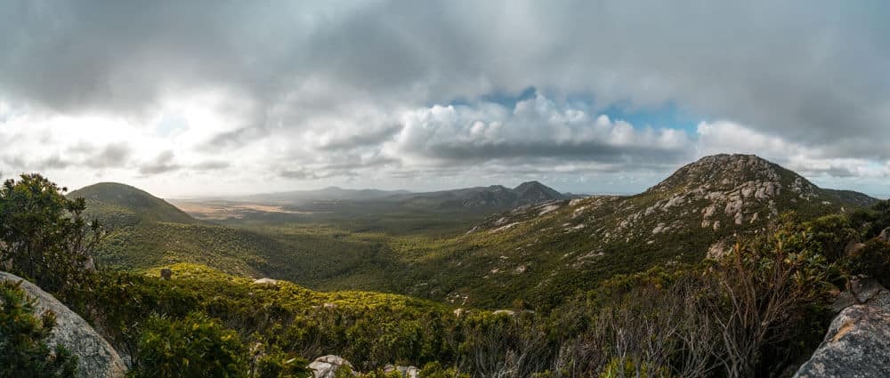
At this point the pace of the expedition slowed down dramatically. I was two paddling days ahead of Ben, Aidan and Alie and while they were out battling the big seas and strong winds of their first day, I struck out to explore the Island. My first objective was to climb the 756m Mt. Strzelecki, the highest point on the Island and interestingly, also part of the Great Dividing Range, which we would later be following on mainland Australia. While the views, as you would imagine we literally breath taking, the highlight for me was on the run back down to the car. I was making excellent time when I suddenly rounded a corner and my brain subconsciously stopped me dead in my tracks. There in front of me was the biggest snake I had ever seen. Wait, make that two. A pair of Tiger Snakes, the 4th most venomous land-snakes in the world were sat right in the middle of the path no more than two metres in front of me. They just watched as I got my camera and tripod out and proceeded to film them, best day ever!
The next morning, I got a call from Ben telling me that he was eating a pie... this was bad news. The team were sat just 20km south of my position on Cape Barren Island, but due to the inclement weather, it would be another couple of days before they would be able to make the crossing to my position. It was such a shame that I had to spend two more days stuck on a paradise island with nothing to do but explore! I spent the time interviewing and filming with a local mountain biking company and discussing what it is like to live on the island and how they managed to make a living there. Even though many of the residents needed to work multiple jobs, they all told me they couldn’t think of anywhere else they would rather live.
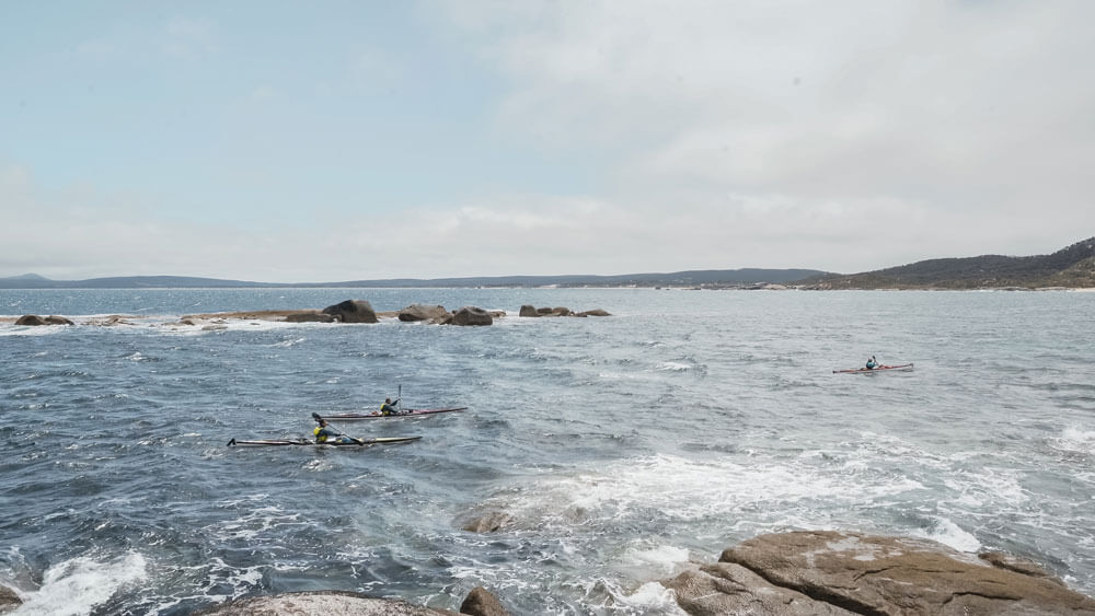
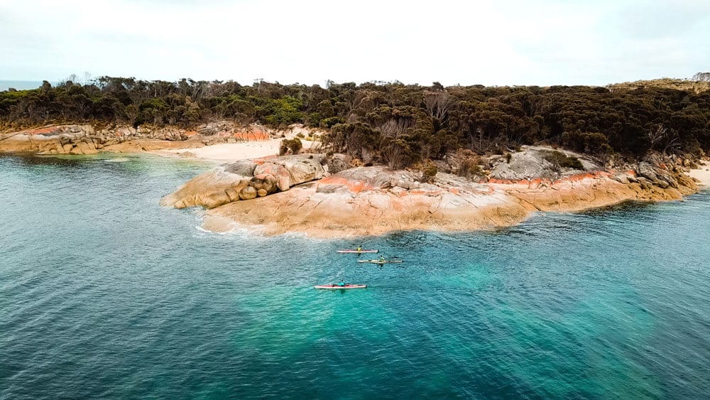
Four days after arriving on Flinders Island, I was out location scouting when I got a satellite message from Ben’s Garmin GPS device to say they had set off. I rushed back to Trousers Point and set up shop; the Sony A7iii, equipped with a Canon FD 100-300mm lens, was sat atop my 3-Legged Thing tripod, and my DJI Mavic Pro drone prepped and ready to launch at a moment’s notice. I was joined by Les and Jenni, two sea kayakers from Western Australia who were waiting for a good weather window to kayak back to Tasmania. We’d spent the last few days chatting over a cup of tea or two and they were keen to welcome Ben and the team to the island. A tense hour crept by gazing though my Hawke Endurance binoculars waiting for the first glace of bobbing heads and splashing paddles. I blinked and suddenly there were there. Four days of waiting had built up to this, I set the A7iii rolling and scrambled the drone.
The very next day Ben and the team made it further along the coast to the main town, Whitemark. But just as we felt we were making progress with the crossing, the weather turned on us again. Strong North-westerly headwinds were forecast, meaning paddling would be off the cards until they changed direction. The mood in camp was understandably tense. Ten minutes wouldn’t go by without at least one of the team checking the weather to see if the wind would be changing any time soon. It wasn’t, and with six days already gone, they were getting ever closer to having to make the call to abandon the crossing. We spent the time eating pies and pizza, exploring the town a little and playing hackie sack (terribly) on the beach. Three days slowly went by, but little change in the weather the mood remained the same. During a series of interviews, I asked the trio whether they though the crossing was still possible, to which the best answer got was a firm maybe. So at least there was still a shred of optimism left.
As it happened, a very small weather window opened the very next day and the decision was made to push a little further north to Roydon Island, a tiny landmass just off the north-west coast of Flinders.
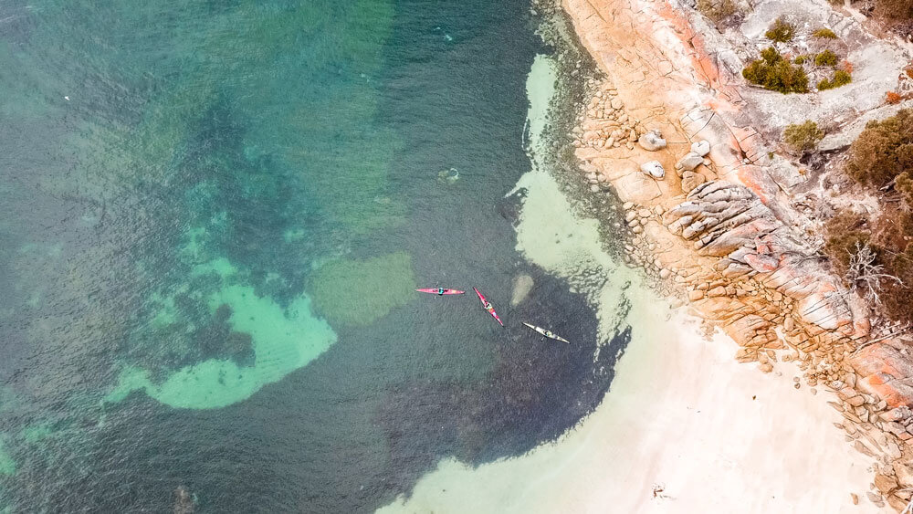
I found myself huddled behind a rock on a headland, sheltering from the battering wind and sporadic rain and watching Ben’s GPS dot move painfully slowly towards my position. After 5 hours of waiting, my patience paid off as I spotted three sea kayaks in the distance, it was go time. I launched the drone and set my camera rolling and with no room for error, I spent an intense 15 minutes trying to capture as much footage as possible before they disappeared into the distance. That was the last time I saw the paddling trio for quite some time.
The team spent another five painfully slow days on Roydon Island, experiencing torrential rain and 80 mph winds. Of course, they always knew there would be an element of waiting involved to complete the crossing, it was inevitable, but I’m not quite sure they were fully prepared for the monotony it provided! In the end Ben, Aidan and Alie managed to complete the crossing in a total of 19 days, 9 days of kayaking and 10 days of waiting!
Ben had always said that if the first two legs went well, then it was basically a done deal that he would become the first person to complete a completely human powered vertical crossing of Australia. Little did he know what difficulties lay ahead of him in the coming weeks...